At last we are all vaccinated and can get together again. Lots of hugs were exchanged and John grilled a boneless leg of lamb to make our day even more festive.


things that keep me up at night
At last we are all vaccinated and can get together again. Lots of hugs were exchanged and John grilled a boneless leg of lamb to make our day even more festive.


We travel along UT 12, probably the scariest road ever. At several points the land drops into canyons on either side of the road with just us and the car on a tiny spine of land. I do not take pictures because first of all, I do not want to look and second, because I have tried to take pictures before and there is no way for the camera to capture the depth of the canyons.

We finally make it to Escalante, UT and find a place to eat some breakfast. The Escalante Outfitters is part serious hiking place and part eco-driven and hippie snack bar. We opt for a crustless egg and vegetable soufflé which turns out to be quite delicious.

As we get nearer to Bryce Canyon we can see the Aquarius Plateau in the distance.

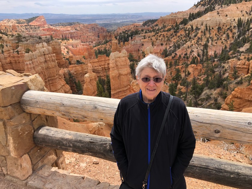
It is our plan to just make one stop in Bryce, at Fairyland Point. We figure with it being the weekend the park will be overrun with tourists. Plus the sky is looking pretty ominous.


We change drivers when we get to I-15 and I end up driving through some of the worst rain I have ever experienced. It is coming down in sheets and the road is hard to see with all the spray from the other cars and trucks. Plus the speed limit is 80 mph!! When we reach St. George the weather miraculously clears up and we stop at a favorite of ours for lunch, Mad Pita Express.

We check into the Inn at Entrada, get ourselves settled, and go shopping at Harmon’s for sushi and lentils for dinner.


After having our sushi hors d’oeuvres we make a lentil stew with mushrooms, carrots, and chicken sausage.

Today we are driving to Boulder, Utah with a stop for a picnic lunch in Capitol Reef National Park. As we drive along the rocks change color and formation. Here is what we saw along the road.


We finally reach our hotel in Boulder, UT. The wind has really picked up and is howling. Our room is not quite ready so we spend some time in the hotel’s common area. Later we go out for a very fine dinner in the only place open in this tiny town.

Today we spend the day at Arches National Park. We go early to make sure we will get to see everything we want. As is by 11 AM our last stop is so crowded that we are unable to find a parking space. By the time we leave around noon the park is closed because it is at capacity.
I have a ton of pictures that I will just caption.


The last thing we are planning on seeing is Devil’s Garden where there are several arches. But the crowds and traffic make it impossible so we decide to leave and let someone else have a chance to get into the park.
We go to downtown Moab and have an excellent pizza at Antica Forma.

The rest of the day we spend shopping for the next day’s picnic and at the hotel watching some TV and planning our adventures for tomorrow.
Friday is mostly a travel day. We decide it will be more fun to take an interesting route and have a picnic along the way than just get back on I-70 and turn left at Green River.

On our way to Gateway, CO which surprisingly has a fancy resort in it, we travel through the Dominguez-Escalante National Conservation Area following along side the West Creek until Gateway where it joins the Delores River. Such a little creek has created beautiful canyons.


After the turn southeast at Gateway the scenery changes and the rock turns red. The Delores River has fashioned these canyons.

We stop at a Point of Interest where the red walls tower over us on one side and the Delores River rushes by far below on the other side. Hanging off the walls above the river is a wooden flume, now in disrepair, that was built in the late 19th century to carry water. The water was used in the extraction of minerals.


These three pictures show where the flume was and a close-up of the wooden construction.


Now we are headed towards the LaSal Mountains. We zigzag up the mountains and head through a pass all the while searching fruitlessly for a picnic spot. Coming down the west slope of the mountains we turn onto US191 and head for Moab, UT. Once again the scenery changes dramatically and we are surround by red walls, columns, and hoodoos. We have our picnic lunch quickly at a rest stop where the wind is blowing and the temperatures are in the low 50s. Brrr.

We get some excellent Thai take-out for dinner and spend the rest of the evening watching tennis and planning our adventures for tomorrow.
Today is our third day in Grand Junction so we are sort of hunting around for things to do. We decide to go to the Museum of Western Colorado, have lunch, and do a little urban archeology.
The Museum of Western Colorado has a very interesting section about the indigenous people of the area, the Utes. The first people, the Toltec, were born from seven caves and were the forerunners of the Aztecs. The Toltec despised the Aztecs and thought they were lower than dogs. The Aztecs, however, were fierce fighters and drove out the Toltec and adopted their creation story. Through studying the Utes, anthropologists have found not only a common cultural thread but also commonality of language with the Aztecs. The Utes were driven out of the Grand Junction area and white settlers were invited in by the US government in the 1880s.

Western Colorado has been the site of uranium mining since 1898. With new applications for radium the area saw a boom of mining in the early 20th century with radium being worth, in today’s dollars, $2700 per milligram. The mining boom busted in the 1920s due to discovery of deposits in the Belgian Congo. A new boom started in 1935 and continued after WWII due to the government stockpiling uranium for nuclear weapons.

Next we head downtown to look at the older buildings in Grand Junction. Mostly the older buildings can be identified by their upper stories. The street level story has usually been repurposed. A lot of the buildings, John comments, have been 19060s-ified with ugly facades which is too bad.


We catch a late lunch at the Main St. Cafe which is in one of the old buildings and has a 1950s theme. I have a salad and sandwich and enjoy reading the numerous signs that abound.


We are both tired out and decide to go back to the hotel which is quite a distance from downtown. Later we go downstairs in the hotel and sit in the bar (!) and have a glass of wine and a burger.
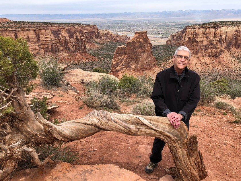
This morning after a glacially slow breakfast at the hotel we make our way over to the Colorado National Monument. The Monument is sparsely attended today so that means we have it mostly to ourselves! Since we are starting at the east entrance we plan on driving the Rim Rock Drive stopping at the viewpoints and when we reach the Visitor’s Center near the west entrance we will do a short hike.
The first stop is Cold Shivers Point. Is that because the wind is blowing and it is still quite chilly this morning or because standing near the edge of the No Thoroughfare Canyon makes one shiver with fear?


The next stop is at Red Canyon Overlook. This is a canyon within a canyon or a hanging canyon. The softer rock eroded quickly (relatively speaking) until it reached the harder rock and then the erosion came to almost a standstill. Only fast moving streams managed to carve out a notch in the Precambrian metamorphic and igneous rock.

Back in the car we go to the next overlook, Ute Canyon View, which also has a short Ute garden interpretive trail. On the trail we learn that yuccas have their needles arranged in a spiral fashion to funnel scarce rain into the plant. Also that these yuccas are completely dependent for pollination on one insect, the yucca moth.

The shrubs and low trees that dot the desert landscape at this elevation are pinyon pines and juniper. The placard informs us that the needles on the pinyon pines grow in pairs.


Our next stop is at Fallen Rock Overlook.

We are interested now in getting to the Visitor’s Center and only stop at two of the last four overlooks. Some grand views are available to see at Grand View Overlook.


Our plan at the Visitor’s Center is to 1) use the restroom and 2) do a short hike along the rim. Pictures from the Rim Trail –


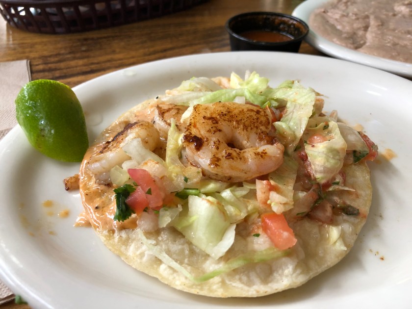
It is well after 2 PM now and time to find some lunch. John suggests we find a vegetarian restaurant somewhere in Fruita, CO, the closest town to the Monument. After finding zero vegetarian restaurants and zero Middle Eastern restaurants we decide on Mi Ranchito, a Mexican restaurant which has gotten 4.5 stars on Yelp. We are tired and hungry which is never a good combination for ordering well.


We head back to the hotel and catch up on our email and lie about playing games on our iPads and nodding off (me.) Dinner around 8 PM is a trip downstairs to the restaurant in the hotel for an order of chicken wings (mostly for John) and a salad for me.
We decide that due to the lack of restaurants and grocery stores we are going to depart Green River today instead of tomorrow. We know there will be more amenities in Grand Junction so we will stay there an extra night. On the way to Grand Junction we will take a hike and spend part of the afternoon taking care of laundry.
Our hike overlooks the Rabbit Valley with the LaSal Mountains in the background out towards Moab. The hike is called Trail Through Time. It has explanatory placards which we really like. The hike is a loop and is about 1.5 miles long. We know it will probably take us two hours what with reading all the placards.

An active dinosaur dig is going on here during the summer months. There are some dinosaur fossils still in situ with explanations about what they were and when they traversed the earth.
We start by an area of paleo soils. The soils here were laid down during the Jurassic Period when this area was near sea level with rivers running through it. The occasional overflow of these rivers laid down layers of mud. The faster drying mud is now reddish stone and the slower drying mud is the gray-green.


Many of the fossilized dinosaur parts are hard to see and harder to photograph but I do take a reasonable picture of the vertebrae of a juvenile diplodocus.

The hillside is all rubble from erosion which helped to expose the dinosaur fossils. We see more dinosaur vertebrae and a hip joint. The really good parts like skulls have been dug out and are in a Colorado museum.

After our hike we still have about an hour to Grand Junction. We are hoping for pho for lunch but are not sure of what is open for in-person dining. Eating a bowl of soup in the car is not appealing.
Even though the internet says that Pho 88 is only open for take-out and delivery, we figure with the changing restrictions now that people have started getting vaccinated that maybe the restaurant will be open. Yay! It’s open and we see people inside. We both order a bowl of pho and commence slurping.

We get to our hotel around 3 PM and take care of our laundry before leaving for dinner at a place we think we have eaten at before now called Le Rouge.
As it turns out, this is the same restaurant we dined in back in 2009. It used to be called Moulin Rouge but ran into trademark problems with the real Moulin Rouge in France. So now it is just Le Rouge and the menu is similar to what we ate before.
We both have the foil gras as a starter. It is strangely unseasoned and needs quite a bit of salt. It is served with toast, thyme, and a sweet, fruit sauce.

For our main courses John has coquilles Saint Jacques. It is kind of a minimalist approach and I might have ordered for myself if I had known it was not going to be in a heavy cream sauce.

I decide to have an appetizer and a salad to split with John. The salad is interesting. It is endive, salad greens, and apples topped with a pistachio/beet dressing. The appetizer is crab cakes with corn and a spicy remoulade sauce.
We also have a bottle of Chateau de Coing 2011 Muscadet.
This is the nicest dinner we have had so far on the trip. It was not perfect but it was so nice to have a pleasant fancy meal.
Today was a travel day that started off with mundane scenery and ended up with the spectacular San Rafael Swell. For most of the morning we drive through the uninhabited parts of dry Nevada and the salt flats of Utah. At lunchtime we find ourselves in Salina, UT where in 2009 we had stopped on one of our cross-country trips at Mom’s Cafe.


Last time we ate there I got their homemade chicken soup which included a chicken-made bone. Today I order a chicken sandwich sans bones. The weirdest thing is that no one there is masked. Not the patrons or the servers. It is a little scary.
Then we are back on the road heading towards the San Rafael Swell. I really wanted to see the amazing geologic feature again as we had gone through it quite quickly last time. Today we stop at the overlooks and read the explanations. It is so grand!
The San Rafael Swell is a section of the earth’s crust that has been eroded and exposed by the upward tilt of the land so that you can easily see millions of years of the earth’s history. In fact in one section you drive right through it. The pictures cannot totally catch the colors and depth of the formations.
Our first stop is at Salt Wash.


Our next stop is at Devil’s Canyon.

As we are approaching the gap in the San Rafael Reef I take a few pictures out the front window of the car.
Our last stop is at the Spotted Wolf Overlook.


Finally a view from the car as we descend.

Soon thereafter we arrive in Green River, UT. It looks like there are only two places open for dinner and the commentary on the reviews say how crowded they are and how you have to wait a long time to get a table. The pictures show communal type tables. I am not ready for this with a bunch of unmasked strangers. So we decide to shop for something to eat at their one small grocery store and make dinner in the room. It is no worse than the dinners we have had in Carson City or Ely.

All the hotels we have been to tackle the pandemic breakfast differently. In Sonoma we were given the “Grab ‘n Go” paper bag, in Carson City we ordered from a pre-set menu of pre-made items, and here in Ely we went one at a time into the food area where we told a staff person what to put on our plate. Everyone must wear masks in all the public areas of the hotel. I look forward to when I can pick out my own bad breakfast mask-less.
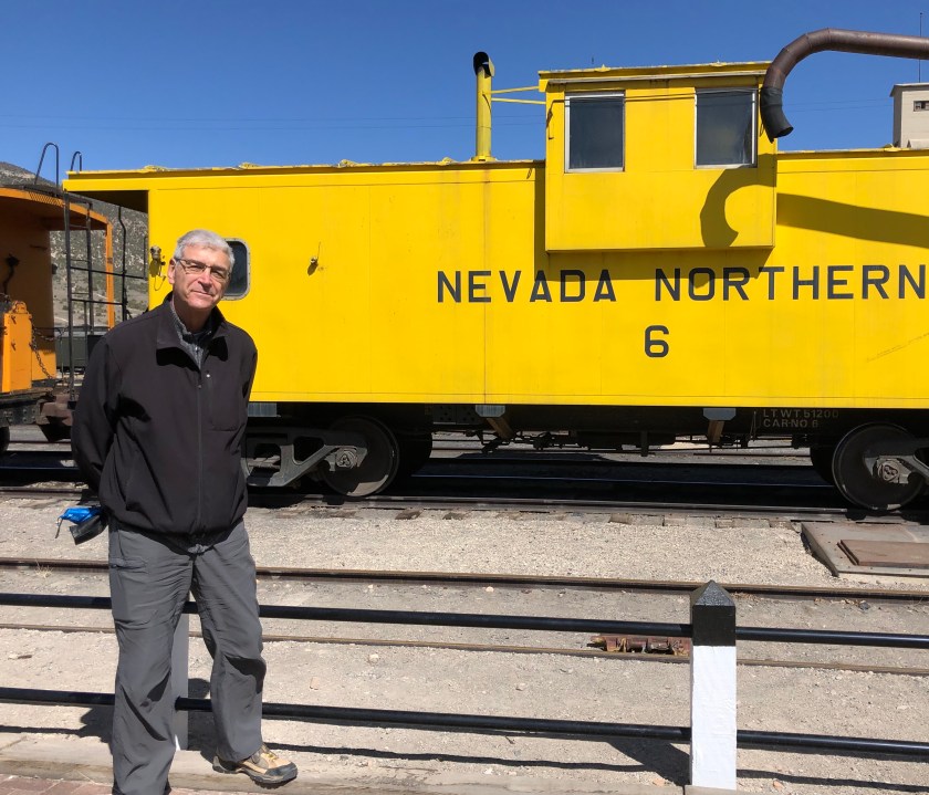
This morning’s outing is to the Nevada Northern Railway Museum and steam engine train ride. It is very chilly this morning, only 26F when we get up with a stiff breeze blowing. We put on a lot of layers. I have six layers plus a scarf and gloves. I am not used to cold weather.

While we wait for boarding time we wander around the train station taking pictures of the train and various items of interest.


There was a thriving copper mining industry around Ely in the late 1800s and up until 1983. The boom time for the town was during WWI. The smelting of the copper was done in a nearby town.
We hear the “All Aboard” and grab some seats for the slow ride to the copper mine with its towering hills of slag. We hear the story of copper mining and see points of interest most of which are broken down coal tipples or dynamited tunnels. We learn about how to use a wye to turn a train around.


After de-training we walk around the site and look at the museum. Two train museums within 3 days is a lot. Then we head off to find some sort of lunch and end up at a Subway standing in a long line. We take our sandwiches back to the room and have out lunch there.
Later in the afternoon we take a scenic ride on the Success Loop. For us it is closer to being the Disaster Loop. Luckily we have had off-road disasters before and know when to bail.
We are riding along enjoying the scenery and pass through some aspens. There are patches of snow on the ground. Uh-oh, we are gaining elevation and the patches of snow are now on the road and we have skidded twice. Then we see the road ahead is entirely covered with snow. What to do?! We know it would be a really bad idea to get stuck out here in the middle of nowhere. It was bad when we were in our 50s and it would be much worse now that we are in our 70s. We must abort the trip and somehow turn around. I get out to inspect an area that might look promising for a K-turn. But its not. I am slipping in the mud that the melting snow has created. I sink in to the tops of my shoes. If we try to turn around here we will get stuck in the mud.
I and my filthy shoes get back in the car and the only solution is to back out down the dirt road until we can find a wide spot that is not too muddy. John does a great job backing which is hard on his neck. He takes little breaks between episodes of back up. Finally we find a spot that we think will work and John turns the car around and disaster is averted. Yay!


And now it is time for dinner. Tonight we are eating at Margaritas, a Mexican restaurant in the Prospector Casino next door to our hotel. I order shrimp fajitas (with mushrooms?) and John orders chicken enchiladas with a poblano sauce. The chips and salsa are good. We are hopeful. But at the end of the night we are trying to rate our three meals today. The categories are Bad, Worse, and Worst. Both John and I decide that our semi-soggy bread on our lunchtime sandwiches does not down-rate it enough to make it lose the top spot at Bad, breakfast comes in at Worse, and dinner is Worst. Even the good salsa and chips and the tasty guacamole cannot pull it out of the bottom. We are starting to rethink our dinner strategy.
